| |||||||||
 | |||||||||
|
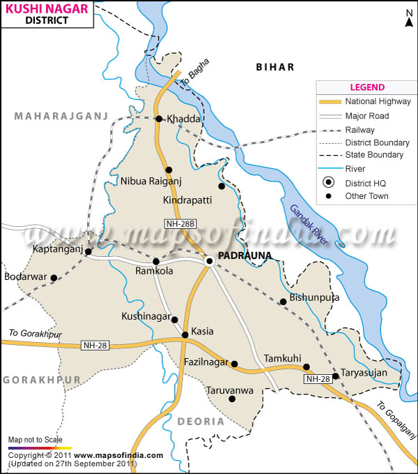
*The Map showing the National Highway, Major roads, other
Roads, District Headquarter, Town and etc in the District, Uttar
Pradesh
Disclaimer: All efforts have been made to make this image accurate. However Compare Infobase Limited and its directors do not own any responsibility for the correctness or authencity of the same.
Disclaimer: All efforts have been made to make this image accurate. However Compare Infobase Limited and its directors do not own any responsibility for the correctness or authencity of the same.
Population in the district of Kushinagar is 35,60,830 .
With a populace of 3560830, agriculture forms Kushinagar?s economic backbone. The district grows sugarcane, paddy, wheat, fruits, and turmeric and also contains a few sugar mills and one distillery.
Kushinagar is a place of immense cultural and religious significance. Every year tourists and apostles of Lord Buddha flock to this holy sanctum whose eminent tourist spots include:
- Mahaparinirvana Temple
- Nirvana Chaitya
- Ramabhar Stupa
- Matha Kuar Shrine
- Meditation Park
- Indo-Japanese-Srilanka Temple
- Wat Thai Temple
- Museum
- Ruins & Brick Structures
- Pawa Nagar
- Sun Temple and other noteworthy detinations.
Last Updated on : 16 January 2012
| Follow us on |
No comments:
Post a Comment